


Buckle up: From Wednesday morning until Friday morning, a large-scale, multi-hazard storm will make living in the central, southern, and eastern United States wet and uncomfortable.
The National Weather Service predicts heavy snow, a wintry mix, drenching rain with potential floods, and severe thunderstorms with possible tornadoes.
On the colder side of the storm, snow is expected from northern Texas to northern New England on Wednesday and Thursday, according to AccuWeather. According to the Weather Service, the area with the greatest likelihood of snow disruption includes south-central Kansas, central Missouri, northern Illinois, and central Michigan.
In Kansas City, St. Louis, and Chicago, where up to half a foot of snow is expected, slick, highly dangerous travel and school delays or cancellations are anticipated.
Heavy snowfall rates might combine with significant wind gusts on the storm’s northwestern flank, resulting in reduced visibility, localised whiteout, or perhaps blizzard conditions, according to AccuWeather.
The weather system has been named Winter Storm Miles by The Weather Channel.
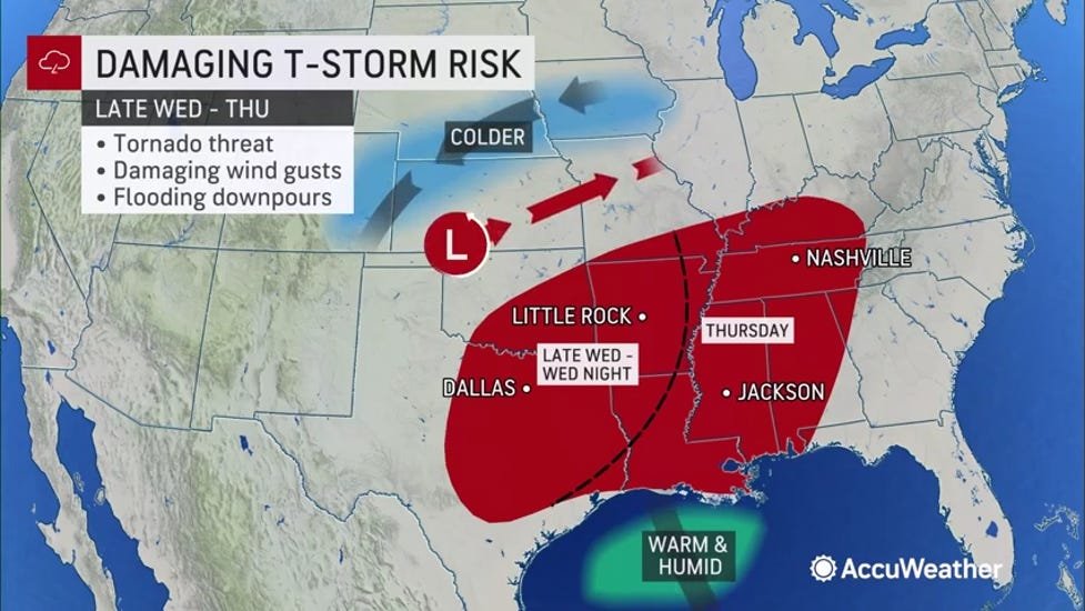
Severe storm warning has been issued for 11 states
In the south-central United States, the storm’s warmer side will increase the risk of severe storms and tornadoes. From Wednesday evening through Thursday, severe weather is expected in 11 states ranging from Texas to Virginia.
AccuWeather meteorologists predict violent storms after dark on Wednesday, with all types of severe weather probable, including damaging wind gusts, huge hail, and isolated tornadoes.
The potential of severe weather will shift eastward into sections of the mid-South and Southeast on Thursday night, according to the National Weather Service.
The Weather Service cautioned that heavy rain could cause dangerous flash floods from the southern Plains to the southern Appalachians on Wednesday night and Thursday night.
SLEET, FREEZING RAIN OR HAIL: Here is the difference
According to AccuWeather, severe weather will develop in the storm’s warm sector, with temperatures increasing to springlike levels in the 50s, 60s, and 70s in the East and 60s, 70s, and 80s in the south-central states.
According to Weather.com, the storm should be out of the Eastern Seaboard by Friday. Given the milder air ahead of the system, mostly rain is forecast all the way up the Northeast coast to Maine, according to Weather.com.


The Chenab Times News Desk